The Laboratory for Environmental Remote Sensing By Drone (TED Lab) contributes to the advancement of knowledge and the development of technology for applying drone-acquired data to environmental problems.


The Environmental Remote Sensing by Drone Laboratory’s (TED Lab) mission is to design and develop innovative solutions for environmental monitoring using drone-embedded sensors and devices. By coupling the benefits of remote sensing with the flexibility of drones, the TED Lab fills a formerly untapped research and development niche.
The TED Lab combines the benefits of remote sensing (quality and quantity of information) with the flexibility of drones. In doing so, it enables researchers to collect new, otherwise inaccessible data respecting:
- Spectral characteristics: broad spectral range, higher spectral resolution
- Temporal characteristics: frequent and timely deployment
- Spatial characteristics: Adjustable spatial scope and resolution depending on requirements, ability to fly over inaccessible areas
Software
- PIX4Dmapper Pro
- Geomatica
- ArcGIS
- RESONON Inc.
- Matlab
- Unscrumbler
- FME
- Ecognition
- Envisat
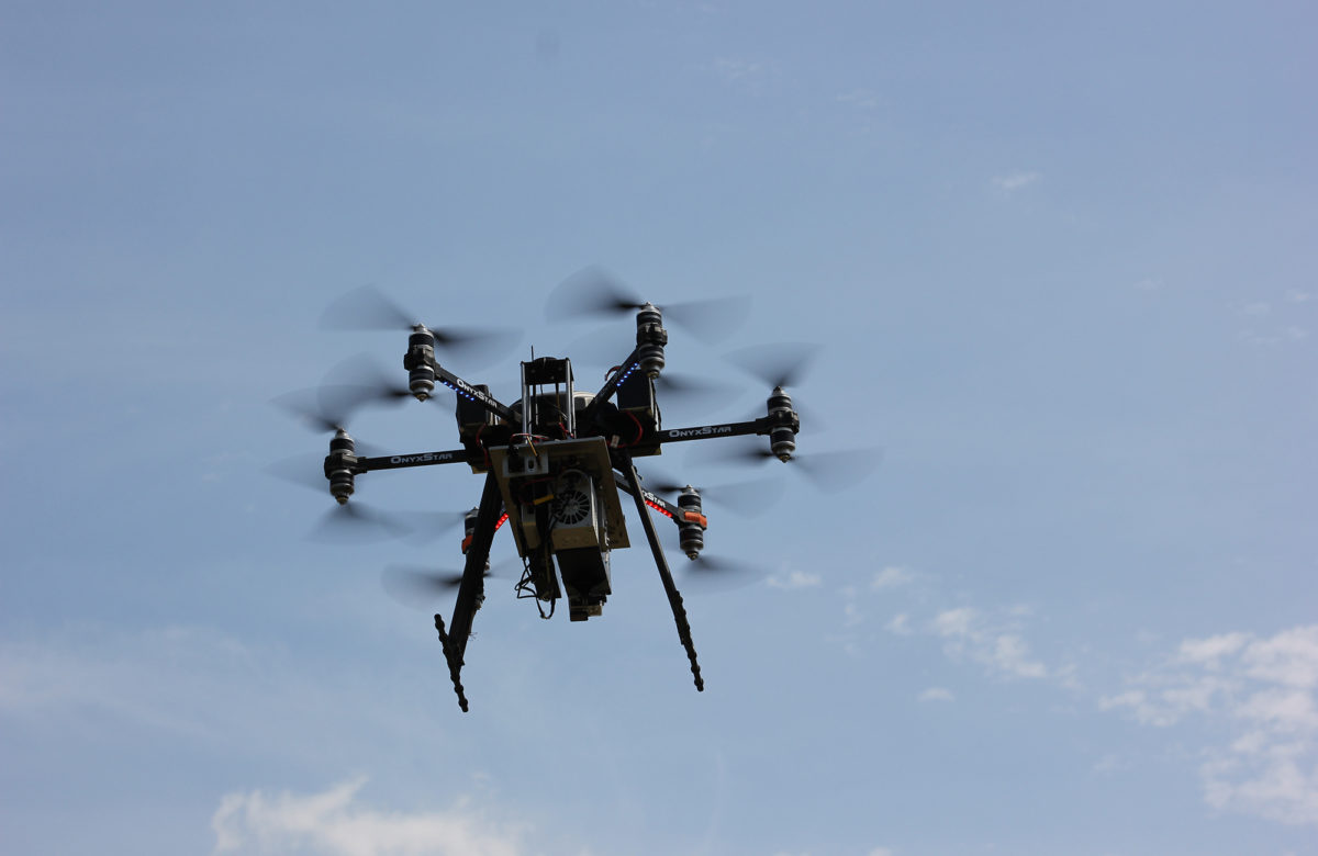
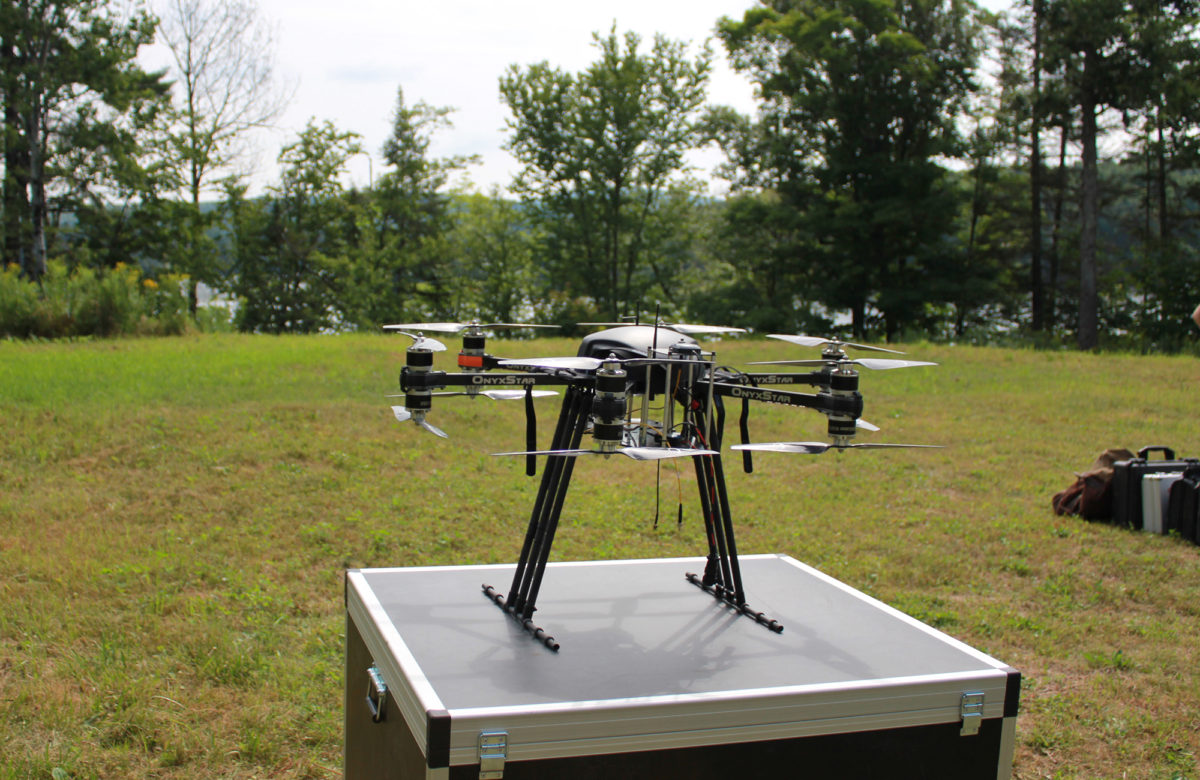
Drones
ALTIGATOR HYDRA-12- 12-rotor multicopter
- Flight time
- 30 min with no payload
- 8 min with 12 kg payload
- Max. payload: 12 kg
- Max. weight at takeoff: 25 kg
- Single-rotor helicopter
- Flight time: 20 min. with no payload
- Max. payload: 7 kg
- Max. weight at takeoff: 20 kg
- 6-rotor multicopter
- Flight time
- 20 min with no payload
- 10-17 min depending on the batteries/payload
- Max. payload: 2 kg
- Max. weight at takeoff: 6 kg
- 4-rotor multicopter
- Training drone
- Flight time: 30 min with no payload
Sensors
LiDAR sensor – system under development, made up of: Velodyne Puck- Range: 100 m
- Wavelength: 905 nm
- Points/sec: 600,000
- Accuracy: +/- 3 cm
- Resolution: 24 Mpx (6000 x 4000 pixels)
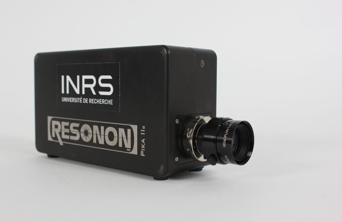
Hyperspectral cameras
RESONON PIKA II- Spectral range: 400 – 900 nm
- Number of spectral channels: 240
- Focal length: 12 mm
- Spatial resolution @ 100 m = 6 cm Coverage @ 100 m = 40 m
- Spectral range: 900 – 1700 nm
- Number of spectral channels: 164
- Focal length: 25 mm
- Spatial resolution @ 100 m = 12 cm
- Coverage @ 100 m = 39 m
Spectrometers
- Ocean Optics USB2000+: Spectral range: 400 – 900 nm
- Ocean Optics NIRQuest: Spectral range: 900 – 1700 nm
Accessories for the proximal spectroscopy device
- Optical fiber
- Light source
- Calibration source
- Optical fiber
- Stand
- Spectralon
Multispectral cameras
TETRACAM MICRO-MCA6 SNAP- Sensors (x6): 1.3 Mpx
- Focal length: 9 mm
- 12 visible bandwidth and near infrared filters
- Spatial resolution @100 m = 5 cm
- Coverage @ 100 m = 70 m
- 16 Mpx (4608 x 3456 pixel) RGB sensor
- 1.2 Mpx narrow band and synchronized sensors (x4: green, red, red-edge, and near infrared)
- Spatial resolution @ 100 m = 9.4 cm (RGB = 2.7 cm)
- Coverage @ 100 m = 120 m (RGB = 126 m)
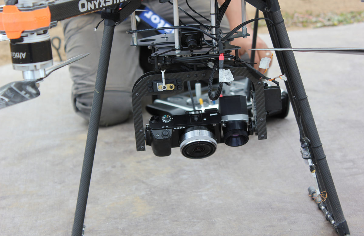
RGB camera - SONY A6000
- Resolution: 24 Mpx (6000 x 4000 pixels)
- Focal length: 16 mm
- Spatial resolution @ 100 m = 2 cm
- Coverage @ 100 m = 130 m
Thermal infrared camera - Optris Pi 640
- Resolution: 0.3 Mpx (640 x 480 pixels)
- Temperature range: -20°C to 900°C
- Spectral range: 7.5 to 13 μm
- Spatial resolution @ 100 m = 9 cm
- Coverage @ 100 m = 60 m
Infrared thermometer - FLIR
- Temperature range: -30ºC to 650ºC
- Accuracy: ±1 ºC or 1% of the reading
- Resolution: 0.1ºC
- Thermocouple (accuracy: ±2ºC or 1% of the reading)
Benchtop hyperspectral imaging system
- Lighting system
- Mounting tower
- Mobile platform
- Data acquisition software
- Proximal acquisition lenses
Positioning system
Trimble 5800- 2 RTK GPS dual-frequency receivers
- Pacific Crest radio transmitter
- Horizontal accuracy = 1 cm, vertical accuracy = 2 cm
- GPS receiver
- Code measurement
- Accurate to within 2 to 5 m
3D printer - Makerbot Replicator+
- Dimensions: 29.5 L x 19.5 W x 16.5 H (cm)
- Resolution: 100 microns
Weather station
Davis Vantage Pro2- Variables measured: precipitation, wind, temperature, humidity, UV radiation
- SR50A acoustic distance sensor
- CS230 temperature profiler
Miscellaneous
- Honda 2200 W inverter generator
- In-the-field computers
- Satellite telephone
- Avionic communication system
- Calibration cables for reflectance
Repair and storage shed - Mobile laboratory
The TED Lab also has a fully equipped trailer for work in the field. The trailer can serve as a command station when drones are in the air or as a laboratory, as needed. Because it has its own power supply, it can be up and running quickly and easily almost anywhere.- Precision agriculture (fertilization, irrigation, erosion, plant protection)
- Aquatic ecosystem monitoring
- Water quality
- Habitat characterization
- Public safety (flooding, ice jams, spills)
- Geomorphology
- Invasive plant detection
- Mining
- Forestry
- Spectroscopy (soil, snow, minerals)
- Orthophotography and 3D modelling
- Satellite data simulations
Funding
The TED Lab was created in 2016 through grants from the Canada Foundation for Innovation and the Government of Quebec.Partners
Recent and current projects
Development of a drone-embedded system for taking surface water samples Funding: Natural Sciences and Engineering Research Council of Canada (NSERC) Partner: DroneXperts Risk assessment of metals determined using remote sensing of dissolved organic carbon ISK Funding: International Copper Association (ICA), Natural Sciences and Engineering Research Council of Canada (NSERC) DAVE ice jam monitoring and warning device (dispositif d’alerte et de vigilance pour les embâcles de glace) Funding: Department of National Defence (Canada)Past projects
Detection and monitoring of blue-green algae bloom (cyanobacteria) by remote sensing Funding: Natural Sciences and Engineering Research Council of Canada (NSERC) Hyperspectral remote sensing for environmental applications Funding: Natural Sciences and Engineering Research Council of Canada (NSERC) Automatic detection of the Colorado potato beetle using ultrahigh-resolution images from a drone Funding: Patates Dolbec, MITACS Intraseasonal management of nitrogenous potato fertilization using drones Funding: Ministère de l'Agriculture, des Pêcheries et de l'Alimentation du Québec (MAPAQ) Use of drone-based hyperspectral imaging to calibrate and validate an algorithm based on Sentinel-2 imaging to monitor freshwater algae blooms and/or cyanobacteria in southern Quebec Funding: Canadian Space Agency (CSA) Use of drone-based thermal imaging to monitor methane emissions at landfills Funding: MITACS, Telops, Natural Sciences and Engineering Research Council of Canada (NSERC) Study on the relationship between thermal imaging data collected by drone and agrometeorological indicators of water stress in potato crops Funding: Research and Development Institute for the Agri-Environment (IRDA), MITACSContacts
Karem Chokmani
Professor and Scientific head
Phone: 418-654-2570
karem.chokmani@inrs.ca
Saeid Homayouni
Professor
Phone: 418-654-2687
saeid.homayouni@inrs.ca
Monique Bernier
Honorary Professor
Phone: 418-654-2585
monique.bernier@inrs.ca
Jimmy Poulin
Research Officer
Drone Pilot, Basic Operations
Phone: 418-654-3729
jimmy.poulin@inrs.ca
Boutaina El Jai
Partnerships and Research Development Advisor
Phone: 418 654-2531
boutaina.el_jai@inrs.ca
Laboratory for Environmental Remote Sensing By Drone (TED Lab)
Institut national de la recherche scientifique
Eau Terre Environnement Research Centre
490 rue de la Couronne
Quebec City, Quebec G1K 9A9
Canada