- Research
- Research
In April the ground is still frozen and cannot absorb snowmelt. Watercourses swell and municipalities prepare for floods. Fortunately, they have some help in decision making.

The E-nundation platform is a management tool that identifies flood risks. Photo: Adobe Stock
Two professors from the Institut National de la Recherche Scientifique (INRS) are working on a management tool and mathematical model to help predict flood damage now and for decades to come.
A powerful flood management tool
Floods are a recurrent phenomenon in spring. This year is no different. But withthe current pandemicsituation, new problems emerge. For example, emergency shelters with people in close contact would not be an option. For any flood event, knowing who is at risk three days in advance is a very helpful information. This is one of the features of the E-nundation platform, brought to market by Geosapiens, a startup founded by INRS researchers. This tool makes it easier to manage flood crisis situations.
E-nundation is the product of some ten years of research by INRS professor Karem Chokmani and his team. It uses hydrological forecasts and land elevation data collected by an airborne laser (LIDAR) to determine flood extent and water depth, and indicate for example, which populated areas need to be evacuated. “We can contact residents 72 hours in advance so they can get ready. They can disconnect the power supply, empty the basement, and make arrangements to stay with family or at a hotel,” explains Professor Chokmani, who still works on E-nundation. To help people better protect their home, E-nundation also calculate how many sandbags they need and where to put them. “With our powerful planning tool, evacuating everyone at the last minute becomes a thing of the past,” added the professor.
Unlike many flood risk management tools, E-nundation is designed for end-users. “It’s for crisis managers and decision makers in municipalities, not for hydrologists,” explained the researcher, an expert in remote sensing and hydrology. Saint-Jean-sur-Richelieu and six Outaouais municipalitieshavealready tested an earlier version of E-nundation known as GARI (Gestion et Analyse du Risque d’Inondation).
Human vulnerability
In addition to being user-friendly, the tool takes the human aspect—vulnerability in the face of floods and access to essential infrastructure—into account. “We’ve developed indicators to tell us which residents will be hit by floods and how high the water will be. For example, will the basement be flooded? The first floor too? The tool also considers indirect exposure, such as a flooded road that blocks emergency vehicles,” says Professor Chokmani. The risk assessment even takes adverse circumstances into account. For the same level of exposure, zones with lower average incomes run a higher risk.
Quantifying the damage
Floods can damage buildings and infrastructure. E-nundation puts a figure on the potential damage, based on the exposure level. The numbers are helpful for insurance companies, and knowing the financial risk makes it easier to determine the long-term financial benefit of protection measures in high-risk zones. “If building a $3 million embankment saves $100,000 a year, is it worth it? Our tool is the only one iIn Canada that can provide all these indicators.”
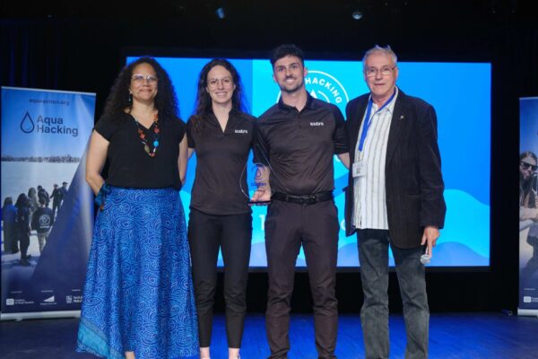
The E-nundation software won first prize in the 2018 Aquahacking challenge and was one of Québec Science magazine’s top 10 inventions for 2019.
Flood models thaht adjust for climate change
In the next few years, floods are expected to be more frequent and more catastrophic. How can we prepare? Professor Taha Ouarda is developing mathematical models to estimate flood risk against the backdrop of climate change.

The tools generate forecasts for specific times, such as the spring freshet. “In April we can accurately assess the likelihood and intensity of a flood using data on the amount of snow on the ground, how fast temperatures are rising, and future rainfall amounts,” explained Professor Ouarda, a statistical hydrometeorology specialist. Information on the state of different indices of low-frequency climate oscillations, i.e. a wave of slow variation, is also used to refine these forecasts.
These predictions can go up to a hundred years in the future and are vital information for essential for the construction of different hydraulic structures such as dam construction. “It’s important to know what conditions a dam will be exposed to in 100 yearsand throughout its lifetime, and how conditions will change,” he added. His team works with entities like the regional county municipality of Vaudreuil-Soulanges and Greater Montreal to estimate coastal flood risks for the coming decades. Protective structures such as embankments can be scaled up or down according to the predictions. Professor Ouarda also works with the International Joint Commission for the management of the Great Lakes on the development of models for forecasting flood flows in the Richelieu River and the flood level of Lake Champlain.
Adding in climate variables
Professor Ouarda’s models have the advantage of pairing long-term climate trends with annual variability signals. Each year the earth’s ocean currents vary in intensity and affect future temperatures and precipitation. Taking these factors into account, predictions of extreme events corresponding to different return periods, such as an intense flood that occurs every two years, are more realistic than those produced by a stationary model that looks to the future without considering annual variations.
Since their first dynamic model in 2007, the researcher and his team are constantly improving their mathematical approach to better simulate reality and model climate change. Artificial intelligence is the key to their work. “We use historical data to develop models take into account the effects of, and interactions among, several variables and predictors. It is important to combine the impacts of a number of explanatory variables and to use sophisticated non-linear approaches in order to be able to simulate the complex dynamics of the modelled phenomena. Linear models are not appropriate because they are not able to take into account several variables and predictors whose combined effect can neutralize or amplify the signal,” he said.
The research group has used their dynamic model to produce new insight on an interesting aspect of the climate change distribution. It is not just the distribution parameters that are changing, but the distribution itself. It is as if a cloud were moving across the sky and changing shape at the same time. Current models do not consider that the nature of the distribution changes over time. Professor Ouarda is already working on new models that would allow for that. Tomorrow’s floods will soon be a secret no more.